As people in southern Manitoba brace for spring to be thrown topsy-turvy into full-blown winter again, here’s what to expect over the next three to four days.
A massive storm centred around a Colorado Low moving through North Dakota and Minnesota is stretching its limbs into the lower Prairies and expected to bring as much as 80 centimetres of snow to some places, along with intense winds.
“This storm has been described as historic,” said Natalie Hasell, a warning preparedness meteorologist with Environment and Climate Change Canada.
Snowfall totals will generally range from 30-50 centimetres but along the western side of the Red River Valley and into the escarpment of Riding Mountain and Turtle Mountain, the amounts will push closer to 80 cm and possibly higher, Hasell said.

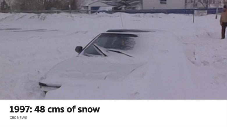
The storm is on par with the three-day one in 1997 that began April 4 and ended April 7, pummelling Winnipeg with 48 cm and 80 cm further south, eventually leading to the Flood of the Century.
This time around, Winnipeg and areas to the north and east are under a storm warning, with winds expected to gust 60-70 km/h. Areas west and southwest of Winnipeg are under a blizzard warning with wind gusts of 70-90 km possible.
In both cases, zero visibility is expected at times and “widespread highway closures [are] a near-certainty,” the warning from Environment Canada says, adding that by Wednesday evening, “even travel within communities may become impossible.”


To be considered a blizzard, the storm must have sustained winds of at least 40 km/h, visibility reduced to at least 400 metres and for those conditions to last for at least four hours.
Communities just outside the warning areas will also be impacted — perhaps not as much to merit warning criteria — but “conditions will likely be difficult,” Hasell said.
Here’s what to expect.
Tuesday night
Southeastern Saskatchewan and areas along the Manitoba-U.S. border will start to see snow and “it will quickly progress” into the Parklands and Interlake and areas east of Lake Winnipeg overnight, said Hasell.
CBC Manitoba meteorologist John Sauder said the first flakes will likely be a mix of wet snow as temperatures remain close to zero.
Communities closer to the border will get their first taste around the supper hour and those in Winnipeg will see the snow starting around 11 p.m.
Wednesday
“We are fully involved,” said Sauder.
All across the warning areas, people are going to wake up to strong northeast winds, dropping temperatures and heavy snow, pretty much from Gimli all the way south, from east to west, Sauder said.
The storm will continue to push north and winds will be gusting to in the highest ranges, especially in the west where the blizzard warnings exist.
Here’s a model simulation of how the upcoming winter storm is expected to evolve over the next couple of days. Model is 3km NAM from today into Thu. Snow (blue) pushes into srn MB this evening and ramps up overnight. Snow may ease over RRV/SE MB later Wed before picking up Thu <a href=”https://t.co/M6IYnR2PMH”>pic.twitter.com/M6IYnR2PMH</a>
—@robsobs
This day will see the stickiest snow with temperatures still hovering around zero.
By the later afternoon or early evening, it might feel a bit like we dodged the worst of it but don’t be fooled, Hasell said.
“This is merely a pause. Imagine this as waves of the storm.”
Sauder says there is a 40 per cent chance of a lull, mostly in southeast Manitoba and the Red River Valley.
“That’s when people are going to be going, ‘That’s it? It’s done,'” he said. “But it’s not. The second wave will move in on Thursday with winds almost as strong and more heavy snow.”
Even during the calm period, without wind gusts blowing snow around, there could be whiteout situations due to thick snowfall, Sauder said.
A total of 15-20 cm is likely by Wednesday afternoon in Winnipeg before the second wave hits and intensifies overnight into Thursday.
Thursday
This is going to be ugly. The storm is in full throttle and northwest winds are strong.
The Colorado Low stalls over Minnesota, keeping Manitoba in its sights the entire day and into Friday.
Temperatures drop so the snow is not as sticky and heavy. Highs will be about –5 C compared to the normal high of 10 C for this time of year.
A further 15-20 cm is likely in the Winnipeg area.
Friday
The system’s Canadian limb begins to move off toward the Great Lakes and impacts northern Ontario.
Although the snowfall will taper off, the winds remain strong, around 30-50 km/h through the morning before dropping off to 20-40 km/h in the afternoon, said Sauder.
Temperatures remain cold at –5 C.
Saturday
A few lingering flurries but the sky begins to clear in the late morning. Temperatures still struggle to get back above zero, sitting around –3 C.
Hope for the snow to start melting is days away, said Sauder.
“I don’t see anything close to the normal for the next week,” he said.
Those below-normal temperatures will result in a freeze-thaw cycle for a few days, so road conditions could still be affected well after the storm system has moved on, said Hasell.


Leave a comment