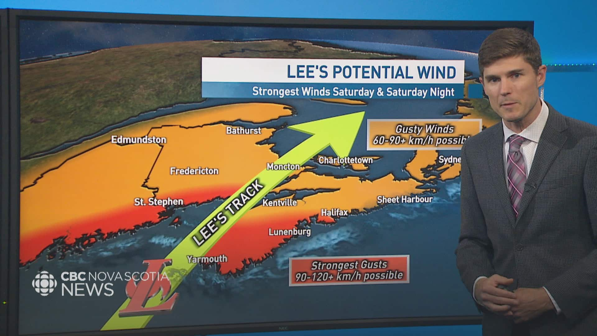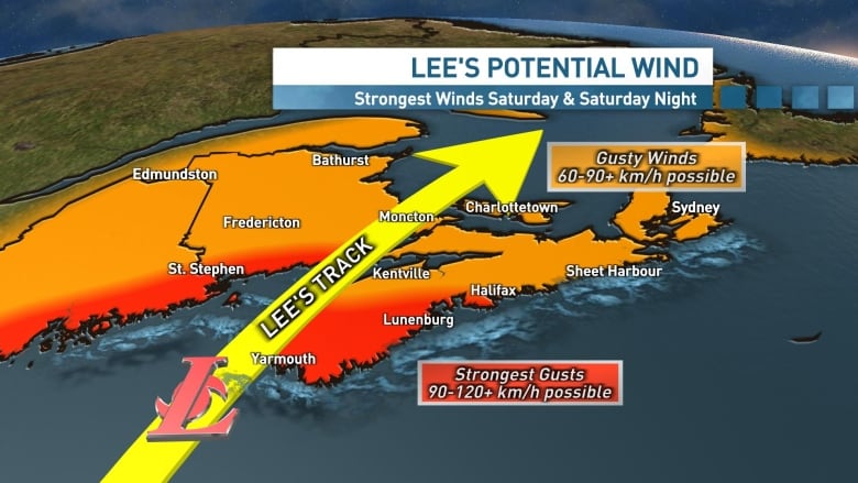
With the trees in full leaf, power outages are very likely, with widespread wind gusts of 60 to 90 kilometres per hour expected across the Maritimes. The long duration of this storm will increase the chances of outages Saturday and Saturday night.
Areas of southwestern Nova Scotia and New Brunswick are likely to experience the strongest winds with the possibility of sustained winds of 60 kilometres per hour and gusts of 90 to 120 kilometres per hour or higher, especially in exposed coastal areas.

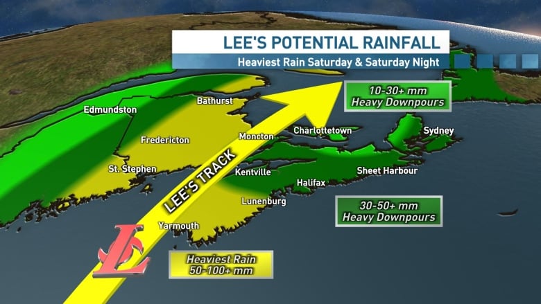
Rainfall amounts will be highest along the northwest of the hurricane’s track. Totals of 50 to 100 millimetres or more are possible in southwestern Nova Scotia and much of New Brunswick, most of which is set to fall on Saturday and Saturday night.
Further east, totals won’t be as high, but heavy downpours are still likely.
Lee is a large storm, so pounding surf is a slam dunk for Saturday, especially for south-facing coastlines. The Atlantic coastline of Nova Scotia is the area most likely to be impacted and the Canadian Hurricane Centre (CHC) is warning of four- to six-metre waves breaking along the coast.
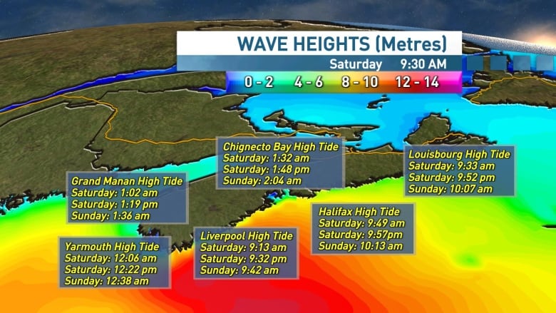
Storm surge is also a concern.
While the Bay of Fundy will need to be watched closely, the CHC has flagged the area of the Atlantic coastline from Shelburne County up to the coast to Queens County and eastern Halifax County as the region most likely to see coastal flooding.
During high tide times, the storm surge combined with waves may push water levels up to one metre above the usual high tide.
So when does the storm arrive and when does it leave? Here’s a breakdown of what to expect.
Meteorologist Ryan Snoddon says Lee could make landfall as a post-tropical storm with tropical storm-force winds at about 110 km per hour, which he notes is just a little bit less than the force of a Category 1 storm.
Friday — Last-minute preparation
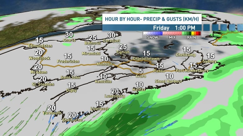
Friday will be a quiet day across the region. Winds will be light and it will be a great day for last-minute preparations.
Friday night — Rain and wind arrive
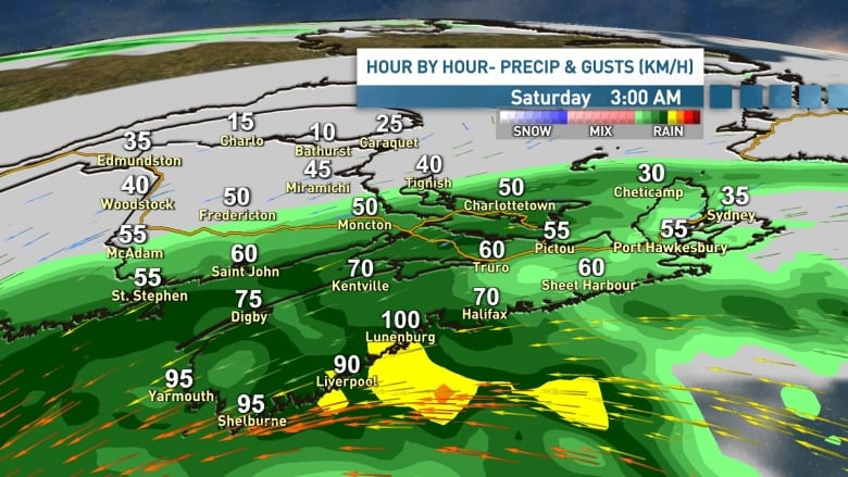
The first rain bands and gusts of wind are set to arrive overnight Friday and into the early morning hours of Saturday.
Saturday morning — Winds ramp up
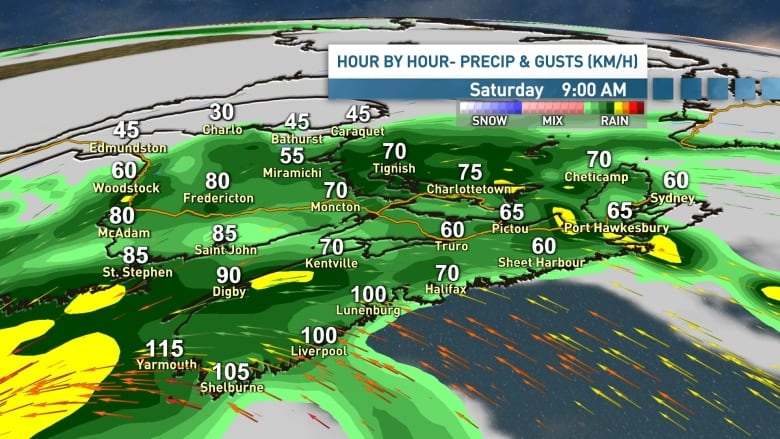
As Lee moves closer to the region, the winds will increase in speed throughout the morning and we’ll see bands of rain, at times heavy, tracking through the region.
Saturday afternoon and evening — Lee makes landfall
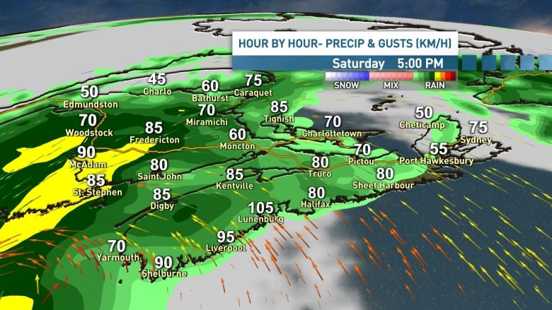
Lee will likely make landfall in the region in the late afternoon or early evening as the periods of rain and gusty winds continue.
Saturday night — Winds remain gusty
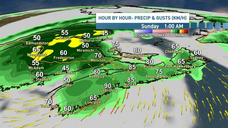
This will be a long storm, so expect the winds to continue to gust through Saturday night as Lee tracks through the region.
Sunday — Lee slowly departs
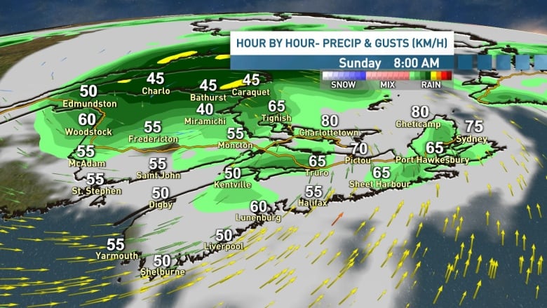
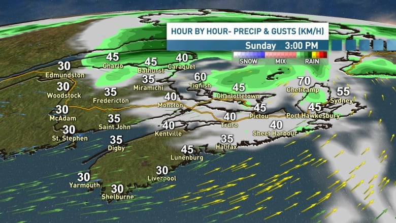
As Lee moves into the Gulf of St. Lawrence on Sunday afternoon, we’ll likely see some sunshine breaking in across Maritimes.
Stay safe and stay tuned for updates over the next few days. Meteorologists Tina Simpkin, Jay Scotland and I will be keeping you posted on TV, radio and online.
View stories on CBC Lite here to save data on your smartphone.
Nova Scotia’s Emergency Management Office suggests being prepared for at least 72 hours without power. Here’s what you should have.

