A global weather phenomenon is coming.
The U.S. National Oceanic and Atmospheric Administration (NOAA) is forecasting an El Niño within the next few months, with a 90 per cent chance that it will carry on into the northern hemisphere winter.
El Niño is a cyclical warming in the Pacific Ocean that, coupled with the atmosphere, can cause a rise in the global temperature. It can also affect weather patterns around the world.
“It’s not 100 per cent. Nothing’s 100 per cent,” said Jon Gottschalck, chief of NOAA’s Climate Prediction Center’s climate operational prediction branch. “But right now, most of the observations and model forecasts are really painting that sort of picture that we’ll go into an El Niño event as we enter the summer months or mid-summer period.”
As well, the forecast El Niño could be mild, or it could be strong, such as the ones in 1997–1998 and 2015–2016, both of which recorded some of the highest global temperatures ever recorded.
Watch La Niña fade and some tell-tale signs that El Niño might be developing in the tropical Pacific Ocean in 2023.<a href=”https://t.co/vVrfIxalGE”>https://t.co/vVrfIxalGE</a> <a href=”https://t.co/H4jIiCIh8k”>pic.twitter.com/H4jIiCIh8k</a>
—@NOAAClimate
While forecasting has certainly become better over the past few decades, the question always remains as to what some of the potential consequences could be for countries already dealing with a warming world, especially Canada, which has warmed at twice the global rate.
The problem is, not all El Niños are created equal. There are several different types, including a coastal El Niño, which occurs off the coast of Peru, or the dateline/Modoki El Niño, where the warming is found mainly in the central equatorial Pacific Ocean. And each of those bring different consequences to different regions of the world.
As the planet continues to warm due to increased CO2 in our atmosphere, the potential El Niño has climatologists and meteorologists on their heels, particularly as we have come out of a “triple-dip” La Niña. The three years of what is essentially the opposite of El Niño — where the region in the Pacific Ocean cools — still saw some of the warmest global temperatures on record.
And a potentially powerful or “super” El Niño could raise global temperatures further above the current 1.2 C of warming compared to pre-industrial times.
The whole El Niño/La Niña system — referred to as the El Niño-Southern Oscillation (ENSO) — has itself been changing. La Niñas have been warming, as have the El Niños and the in-between period of neutral observations.
WATCH | El Niño and La Niña explained:
“What’s interesting about this, and I think it’s so important to remember, is all of these events are getting warmer,” said Simon Donner, climate scientist and professor at the University of British Columbia. “If we do end up with a strong El Niño event, if that same event happened in the 1800s, it simply wouldn’t be as warm and the impacts wouldn’t be as strong.”
Just look at 2021, when during the “cool” La Niña, Western Canada saw devastating heat waves that contributed to the deaths of roughly 600 people. An all-time Canadian record-high temperature of 49.6 C was recorded in Lytton, B.C., which was practically wiped off the map during a particularly catastrophic wildfire season.
Trying to determine the potential fallout in terms of extreme weather events in the ENSO cycle is especially difficult in the time of global warming.
Different types of El Niños
El Niño first came into the public consciousness in 1983, as it was the first major one in recent history that brought with it severe flooding and drought to various parts of the world. But it wasn’t until 1997–1998 that the El Niño truly burst on the scene.
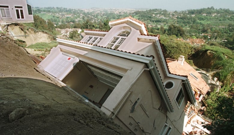
That season, heavy rains drenched parts of California, resulting in major agricultural damage that totalled roughly $1 billion US and killed 19 people. Globally, more than 23,000 people died. Images of landslides and floods were splashed across television screens. There were even bumper stickers that read, “Don’t blame me! Blame El Niño!”

Because it was what climatologists refer to as a “super El Niño,” and because it was one of the first ones that was forecast accurately, today El Niño is in our collective consciousness — even if we don’t completely understand the complicated cycle.
We’ve had several other El Niños that haven’t been as strong, but those don’t pique the interest of the public nearly as much as those that are “super,” defined as when the Pacific warming has been 1 C to almost 3 C warmer than average (the NOAA criteria for an El Niño is three months of 0.5 C-above average surface sea temperatures in a specific region of the Pacific Ocean, but not all weather agencies use this criteria).

And this can be problematic, said Donner.
“What I worry about with this is that, when we group all El Niño events together, we end up misleading people about what to expect in their part of the world,” he said. “It’s like moving where stones are in a stream: you move the stones, the water flow around those stones is going to change.”
What can we expect in Canada?
Typically, El Niño affects Canada in the winter and spring, bringing milder temperatures, particularly in the northwest, west and Central Canada. While it doesn’t usually affect Eastern Canada, it can reduce the number of hurricanes.
On Thursday, NOAA released their hurricane outlook and forecast a 40 per cent chance that the Atlantic hurricane season will be near-normal, good news for Atlantic Canada. El Niño accounts for 33 per cent to 38 per cent of the variance in the Atlantic basin, they said in a press conference. Other factors, such as African monsoons, could affect that forecast, however.
During an El Niño, the annual temperature in Canada also tends to be milder.
“There have been some events where … North America has been above–normal during some of the strong El Niño events,” said NOAA’s Gottschalck. “So one other reason that people I think harness into El Niño is that typically, there’s less snowfall, and a lot of people like snow, or they’re interested in that.”
In 2015–2016, which brought the next super El Niño, meteorological winter (December, January and February) was 1 C to 5 C warmer than normal in all provinces and territories, most notably in the Yukon, the central Prairies and Quebec.
Globally, 2016 was the warmest on record.
“If you really look at the data, for the past few decades, you see that in the really strong El Niño events — like super El Niño events — the warmth and sort of dryness pretty much stretches all the way over to Ontario,” Donner said.
“Western and central Canada stretching all the way over into Ontario would generally experience a dry winter, and an unusually mild winter that usually stretches stretches into the spring.”
It’s important to note that the world is warming with or without El Niño’s help. Of the top 10 global hottest years on record, nine have all occurred since 2014. And within that period, the ENSO cycle has been either mainly neutral or with La Niñas.
The biggest challenge for forecasting in Canada is about what type of El Niño event this is going to be, Donner said.
“Because right now, all of the big meteorological agencies in the world and all the models are saying we’re aiming toward El Niño conditions, but they’re using a prediction system that mixes different types of El Niño together,” he said.
“And if we end up with a classic, powerful El Niño event like 2015–2016, you could say it’s fairly certain we’re going to have a dry and mild winter here in Canada. If we end up with one of these sorts of central Pacific El Niño events, or what the Japanese call an El Niño Modoki, the effects in Canadian weather are less certain.”


